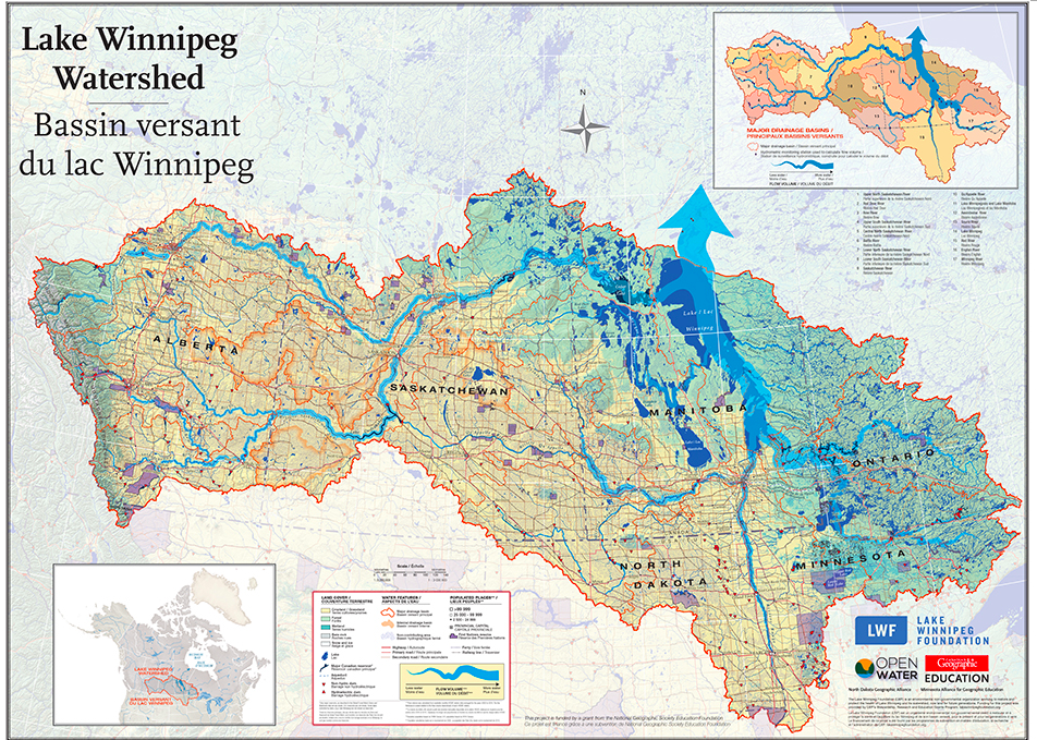
Lake Winnipeg is known as the sixth Great Lake in North America, with a drainage basin of nearly 1,000,000km2. As the second-largest watershed in Canada, covering parts of four provinces and four U.S. states, it is home to more than seven million people.
Unfortunately, in 2013 Lake Winnipeg was named as the “Most Threatened Lake of the Year” as a result of having the highest chlorophyll concentrations of any of the largest lakes in the world.Through the OPEN Water map and associated resources teachers and students can strengthen their understanding of the issues facing the watershed and their commitment to environmental stewardship.
You can start to explore the Watershed through this tiled map, made possible through a grant from the Lake Winnipeg Foundation, and the activities found below.
Associated Materials
- Map and student-friendly citizen science project on iNaturalist
- Guide for teachers and students to do a BioBlitz in their area from the National Geographic Society
- Guide with examples of using the data in the classroom
- Handout on ways to integrate this into your classroom
- Can Geo in the Classroom activity
