Take a trip with us on the Parks Canada Giant Floor Map which highlights Canada’s unique geography, cultures, and histories, and explores how Parks Canada is integral to protecting, conserving, and celebrating nature and culture.
As an agency of the Government of Canada, Parks Canada administers and protects areas of ecological, cultural and historical significance in Canada. They work to guide learners of all ages towards understanding Canada’s rich environmental and cultural history through unique learning experiences, both within and outside of Parks Canada administered sites.
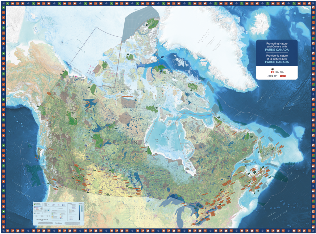
This map reflects the omnipresence of Indigenous Peoples across the land by highlighting treaty boundaries alongside provincial and international boundaries, all 634 First Nations, Métis settlements in Alberta, and Inuit communities in the North that make up Inuit Nunangat, and Indigenous languages. Canada’s progress with respect to the conservation and protection of land and water is also evident through the identification of over 200 sites administered by Parks Canada (as well as non-Parks Canada areas).
The accompanying learning activities will teach students about national parks, national historic sites, national marine conservation areas and national urban parks located across Canada, and will help them to think critically about the people and fauna that call these places home. We hope that this resource inspires students to get outdoors and explore all that Canada has to offer, and that they step off the map ready to commit, as Parks Canada has, to protecting our home.