Freshwater: Lifeblood of the Land
Explore Canada’s freshwater systems from coast to coast to coast on this giant floor map. Trace rivers from local watersheds to the ocean, discover where glaciers, lakes, groundwater and other freshwater sources are found, and investigate how water moves through the water cycle. Students can explore the many ways communities, ecosystems, agriculture, industry, energy and transportation depend on freshwater — and consider how these relationships vary across the country.
The map also invites students to explore Indigenous languages and relationships with water, learn about people and communities working to protect freshwater and consider their own responsibilities toward water. Through hands-on activities, students can investigate where they live, the water systems they are connected to, the challenges facing freshwater and the many careers and pathways that can contribute to a freshwater future.
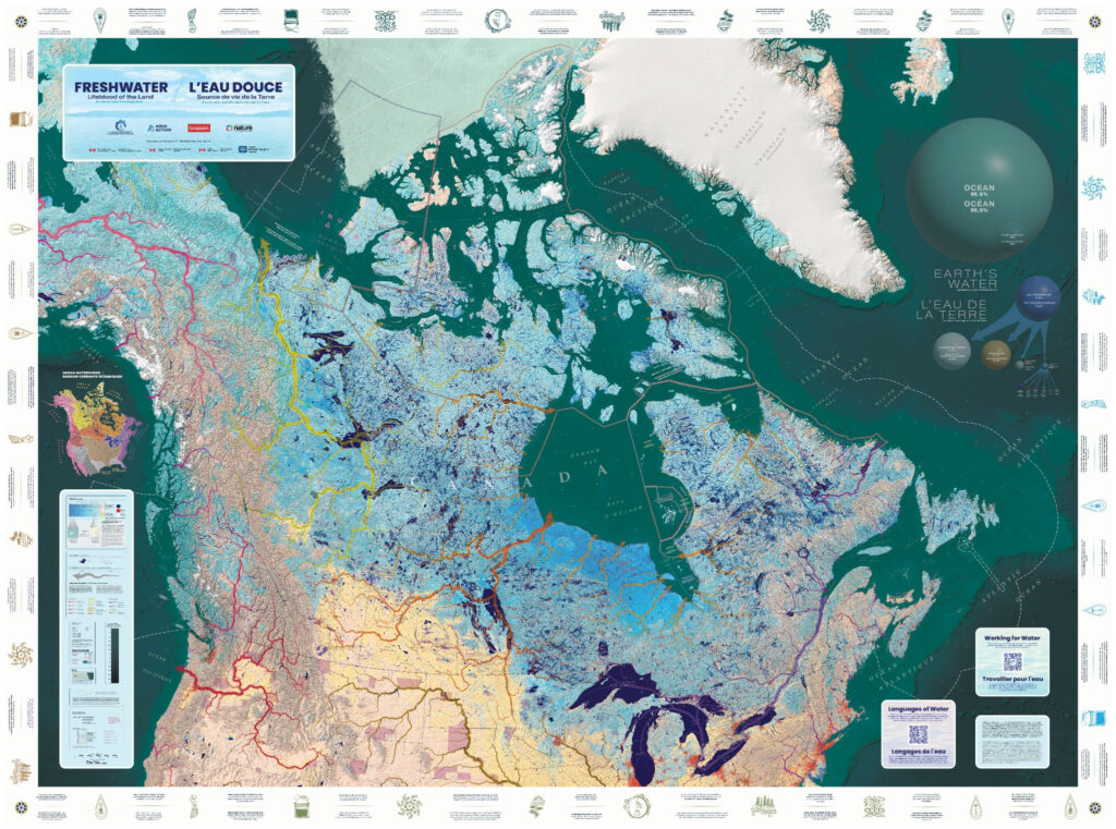
The Freshwater: Lifeblood of the Land Giant Floor Map was created by Canadian Geographic, in partnership with AquaAction and The Canadian Museum of Nature, as part of The Water Literacy Project, Canada’s leading freshwater education initiative.